Neuvition Titan M1-Plus Build for 3D mapping
作者: 嶺緯科技發(fā)表時(shí)間:2020-07-21 10:01:19
Introduction:
3D mapping, another wonderful technology of modern world, is a new machine vision technology in the field of cartography. While we are already familiar with 2D maps?and 3D vision, it is not hard to imagine how a 3D map looks like? 3D mapping means profiling of objects in three dimensions to map out the corresponding objects in real-world. There are several ways for a 3D profiling of an area or object, such as using a pair of a stereo camera. Another method is to measure the depth of an object or feature from focus.
Traditionally, 3D mapping has extremely high cost due to the cost of hardware and software, it limited the use of 3D mapping.
Challenges:
Accuracy of measurement
Resolution of 3D map
Detect objects in longer distance.
High cost of operation.

Featured Product:
Titan M1-Plus
Solutions:
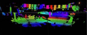
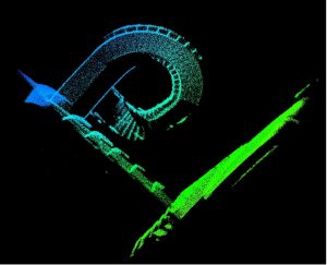
Titan M1-Plus is Neuvition Solid State Mems LiDAR. it can detect 200 meters away, with 480 lines and up to 1750 points per line. It can be mounted on a stationary post to measure objects, can also put on a car or UAV to detect environment, significantly improve 3D mapping efficiency.

Benefits:
Easy installation, it supports Linux and windows versions.Conveniently use, we have our own software-Neuvition viewer and free ROS driver, it helps output the 3D point cloud data and can be integrated with other 3D mapping solution easily.
Cost-effective, compared to competing products, it costs much less.High-performance, very high data rate and high resolution with the close to VGA or 720p resolution. Best for 3D mapping.
